SAOCOM-1
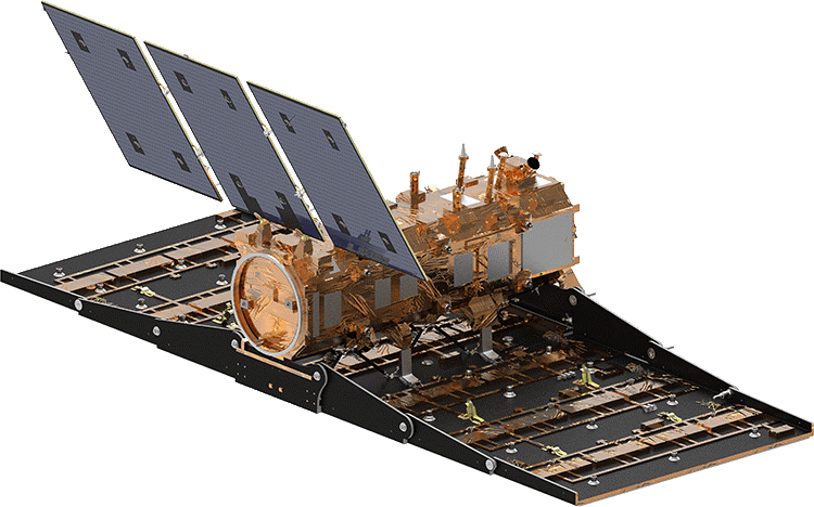 Figure 1 - Illustation of SAOCOM spacecraft (image credit: CONAE)
About the mission/sensor
SAOCOM (Satélite Argentino de Observación COn Microondas, Spanish for Argentine Microwaves Observation Satellite) is an Earth Observation satellite constellation of Comisión Nacional de Actividades Espaciales (CONAE) the Argentina's space agency. The constellation comprises two satellite (SAOCOM 1A and 1B) both equipped with a L-band (12.75 GHz) full polarimetric SAR sensor.
SAR acquistion imaging modes are TOPSAR Wide (TW), TOPSAR Narrow (TN) and Stripmap (SM) with Single, Dual (HH/HV, VV/VH) and Quad Polarization.
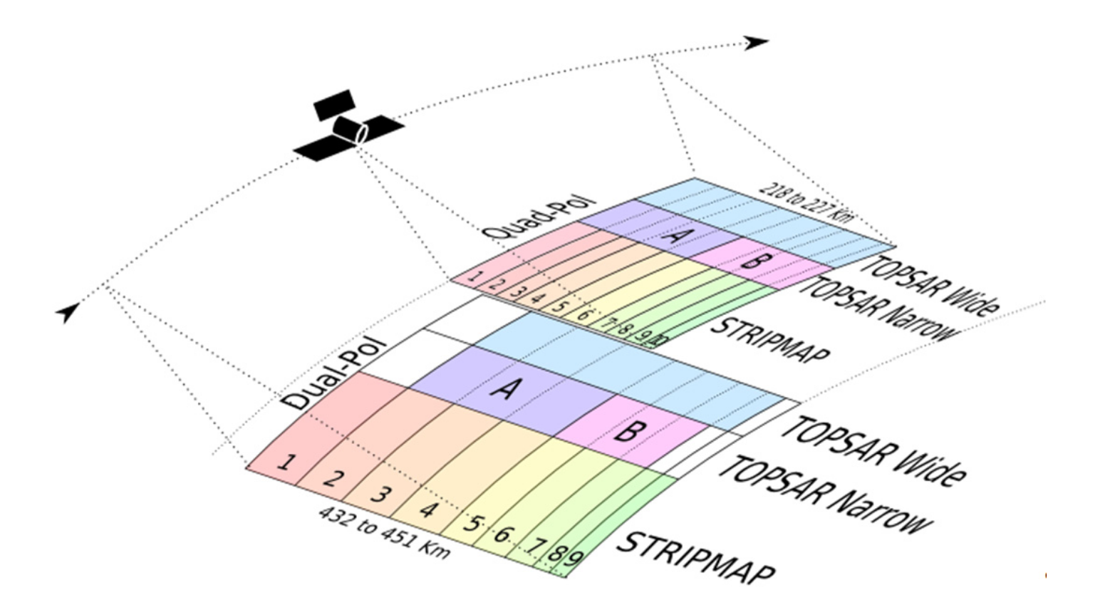 Figure 2 - SAOCOM-1 Measurement modes (image credit: CONAE)
Main characteristics of the Level 1 products of the SAOCOM-1 mission are aviable in the table below (RD01).
| Beam Mode | Beam
Position |
Minimum
Incidence Angle Range |
Nominal Spatial
Resolution |
Minimum
Swath Width (ground range) [km] |
Nominal
Azimuth Length [km] |
Nominal Equivalent
Number of Looks |
|||
| L1A
Products |
L1B, L1C,
and L1D Products |
L1A
(SLC) |
L1B (DI),
L1C (GEC), L1D (GTC) |
||||||
| Near
range [deg] |
Far
range [deg] |
Ground
Range x Azimuth [m x m] |
Ground
Range x Azimuth [m x m] |
||||||
| Stripmap
Single Pol and Dual Pol |
S1 | 20.7 | 25.0 | 10 x 5 | 10 x 10 | 49.7 | 74.1 | 1 | 2 |
| S2 | 24.9 | 29.2 | 52.3 | ||||||
| S3 | 29.1 | 33.8 | 61.4 | ||||||
| S4 | 33.7 | 38.3 | 65.7 | ||||||
| S5 | 38.2 | 41.3 | 49.1 | ||||||
| S6 | 41.3 | 44.5 | 55.6 | ||||||
| S7 | 44.6 | 47.1 | 48.0 | ||||||
| S8 | 47.2 | 48.7 | 31.9 | ||||||
| S9 | 48.8 | 50.2 | 31.1 | ||||||
| Stripmap
Quad Pol |
S1 | 17.6 | 19.6 | 10 x 6 | 10 x 10 | 21.9 | 74.1 | 1 | 2 |
| S2 | 19.5 | 21.5 | 22.0 | ||||||
| S3 | 21.4 | 23.3 | 21.0 | ||||||
| S4 | 23.2 | 25.4 | 25.4 | ||||||
| S5 | 25.3 | 27.3 | 23.4 | ||||||
| S6 | 27.2 | 29.6 | 29.4 | ||||||
| S7 | 29.6 | 31.2 | 20.9 | ||||||
| S8 | 31.2 | 33.0 | 25.1 | ||||||
| S9 | 33.0 | 34.6 | 22.1 | ||||||
| S10 | 34.6 | 35.5 | 14.2 | ||||||
| TOPSAR
Narrow Single Pol and Dual Pol |
TNA | 24.9 | 38.3 | 10 x 30 | 30 x 30 | 176.3 | 222.3 | 1 | 3 |
| TNB | 38.2 | 47.1 | 150.2 | ||||||
| TOPSAR
Narrow Quad Pol |
TNA | 17.6 | 27.3 | 10 x 50 | 50 x 50 | 109.9 | 222.3 | 1 | 5 |
| TNB | 27.2 | 35.5 | 108.8 | ||||||
| TOPSAR
Wide Single Pol and Dual Pol |
TW | 24.9 | 48.7 | 10 x 50 | 50 x 50 | 353.7 | 444.6 | 1 | 5 |
| TOPSAR
Wide Quad Pol |
TW | 17.6 | 35.5 | 10 x 100 | 100 x 100 | 218.1 | 444.6 | 1 | 10 |
Native format
CONAE often provides SAR Geocoded Terrain Corrected (GTC) L1D products which are which are radiometrically calibrated, geocoded backscatter images acquired from SAOCOM-1 A/B satellites. SAOCOM-1 GTC products are provided to mCube as XML Annotated SAR Ground Terrain Corrected Image within a compressed archive containing:
- an XEMT metadata file
- XML and BIN files for Data (includes multiple single-band GRD product for each polarization)
- XML and BIN files for Quality
- XML and BIN files for Config
- a KML file of Scene Quicklook Map Overlay
- a PNG file of Merged Beams Quicklook
Reference Documents
RD01 - Saocom-1 Level 1 Products Format, CONAE, Jan 2020.
Reference Websites
RW01 - SAOCOM official website