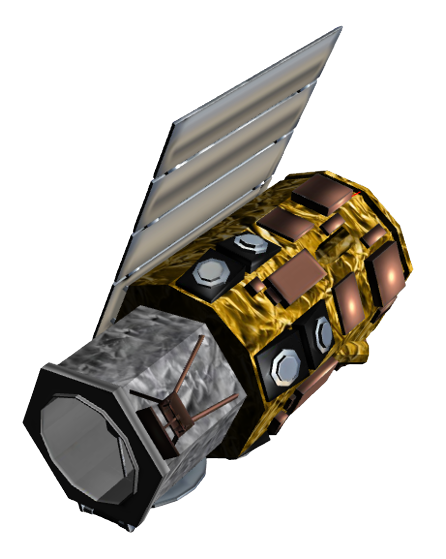
GeoEye-1
Mission and sensor parameters
Launched on the 6 September 2008, GeoEye-1 is an operational earth imaging satellite which is part of the WorldView constellation (QuickBird, WorldView-1/-2/-3/-4 and GeoEye-1 satellites) and is owned by DigitalGlobe in the United States. Operated by Maxar the GeoEye-1 high resolution optical products are available as part of the Maxar Standard Satellite Imagery products.
Mission parameters
| Parameter | Specifications |
|---|---|
| EO Mission | GeoEye-1 |
| Providing Agency | NGA, Maxar Technologies |
| Date of launch | 2008-09-06 |
| Temporal coverage | 2008-10-01 - present |
| Mission status | onGoing |
| Mission Life Expected | >10 years |
| Orbit Type | Sun-synchronous |
| Equator crossing Time | 10:30 AM descending node |
| Orbit Height | 681 km |
| Orbit Period | 98 min |
| Revisit Frequency | 2.6 days at 30° off-nadir |
| Nominal Swath Width | 15.3 km at nadir |
Table 1 - GeoEye-1 mission parameters.
Sensor specifications
Below specifications of the GeoEye Imaging System (GIS) optical earth observation sensor on board the GeoEye-1 platform.
| Parameter | Specifications |
|---|---|
| Imager Type | Pushbroom imager. Line scan imaging system with TDI (Time Delay Integration) capability |
| Imaging Mode | PAN and MS (VIS, NIR) |
| Pan spectral range | 450 - 800 nm |
| Blue spectral range | 450 - 510 nm |
| Green spectral range | 510 - 580 nm |
| Red spectral range | 655 - 690 nm |
| NIR spectral range | 780 - 920 nm |
| Resolution | Very High Resolution - VHR (0 - 5m) |
| GSD | 41 cm (PAN) and 1.65 (MS) at nadir |
| Dynamic Range | 11-bits per pixel |
Table 2 - GeoEye-1 GIS sensor parameters.
Ingested format
Information extracted from product annotation included in the STAC item of a GeoEye-1 dataset are listed below
Properties
STAC item content about properties for a Geoeye-1 Dataset is the following:
  "properties": {
    "platform": "geoeye-1",
    "constellation": "geoeye-1",
    "mission": "geoeye-1",
    "instruments": [
      "msi"
    ],
    "sensor_type": "optical",
    "gsd": 2,
    "datetime": "2022-08-27T02:33:18Z",
    "created": "2022-08-30T00:08:22.8259172Z",
    "updated": "2022-08-31T15:51:14.6206451Z",
    "title": "GEOEYE-1 MSI LV1B 2022-08-27 02:33:18",
    "providers": [
      {
        "name": "Maxar",
        "roles": [
          "licensor"
        ]
      }
    ],
    "license": "proprietary"
  }
View
STAC item content about View Geometry for a Geoeye-1 Dataset is the following:
  "properties": {
    "view:sun_azimuth": 106.4,
    "view:sun_elevation": 69,
  }
Processing
STAC item content about Processing for a Geoeye-1 Dataset is the following:
  "properties": {
    "processing:level": "LV1B"
  }
Geometry
STAC item content about Geometry for a Geoeye-1 Dataset is the following:
  "geometry": {
    "type": "Polygon",
    "coordinates": [
      [
        [
          121.544444444444,
          17.0383333333333
        ],
        [
          121.6925,
          17.0383333333333
        ],
        [
          121.6925,
          17.0708333333333
        ],
        [
          121.544444444444,
          17.0708333333333
        ],
        [
          121.544444444444,
          17.0383333333333
        ]
      ]
    ]
  },
  "bbox": [
    121.544444444444,
    17.0383333333333,
    121.6925,
    17.0708333333333
  ]
Assets
STAC item content about assets (annotation, quicklooks and spectral bands files harvested from the source product) and EO bands for a Geoeye-1 Dataset is the following:
  "assets": {
    "overview": {
      "type": "image/jpeg",
      "roles": [
        "overview"
      ],
      "href": "https://.../GE01N17_054583E121_6184722022082700000000MS01/overview.jpg",
      "filename": "GE01N17_054583E121_6184722022082700000000MS01_BU003002001.jpg",
      "file:size": 30580
    },
    "metadata": {
      "type": "text/plain",
      "roles": [
        "metadata"
      ],
      "href": "https://.../GE01N17_054583E121_6184722022082700000000MS01/metadata.txt",
      "filename": "GE01N17_054583E121_6184722022082700000000MS01_DU003002001.txt",
      "file:size": 1931
    },
    "bluegreenrednir": {
      "type": "image/tiff",
      "roles": [
        "data",
        "dn"
      ],
      "href": "https://.../GE01N17_054583E121_6184722022082700000000MS01/bluegreenrednir.tif",
      "filename": "GE01N17_054583E121_6184722022082700000000MS01_GU003002001.tif",
      "file:size": 251691672,
      "gsd": 2,
      "proj:shape": [
        3072,
        10240
      ],
      "eo:bands": [
        {
          "name": "blue",
          "common_name": "blue",
          "center_wavelength": 0.48,
          "solar_illumination": 1993.18,
          "full_width_half_max": 0.03
        },
        {
          "name": "green",
          "common_name": "green",
          "center_wavelength": 0.545,
          "solar_illumination": 1828.83,
          "full_width_half_max": 0.03
        },
        {
          "name": "red",
          "common_name": "red",
          "center_wavelength": 0.673,
          "solar_illumination": 1491.49,
          "full_width_half_max": 0.03
        },
        {
          "name": "nir08",
          "common_name": "nir08",
          "center_wavelength": 0.85,
          "solar_illumination": 1022.58,
          "full_width_half_max": 0.03
        }
      ],
      "raster:bands": [
        {
          "scale": 0.15652844999999999,
          "offset": -4.537
        },
        {
          "scale": 0.17079901999999997,
          "offset": -4.175
        },
        {
          "scale": 0.1616161485142857,
          "offset": -3.754
        },
        {
          "scale": 0.09535441999999998,
          "offset": -3.87
        }
      ]
    },
    "rpb": {
      "type": "application/octet-stream",
      "roles": [
        "metadata"
      ],
      "href": "https://.../GE01N17_054583E121_6184722022082700000000MS01/rpb.RPB",
      "filename": "vendor_metadata/22AUG27023318-M1BS-506728946010_01_P002.RPB",
      "file:size": 1862
    },
    "manifest": {
      "type": "application/xml",
      "roles": [
        "metadata"
      ],
      "href": "https://.../GE01N17_054583E121_6184722022082700000000MS01/manifest.XML",
      "filename": "vendor_metadata/22AUG27023318-M1BS-506728946010_01_P002.XML",
      "file:size": 1110700
    },
    "thumbnail": {
      "type": "image/jpeg",
      "roles": [
        "thumbnail"
      ],
      "title": "Acquisition Thumbnail",
      "href": "https://.../GE01N17_054583E121_6184722022082700000000MS01/thumbnail.jpg"
    }
  },
Product Calibration
For GeoEye-1 products calibration refer to the Optical Products Calibration (OPT-Calib) service and the calibration sheet available here.