mCube User Manual
![]()
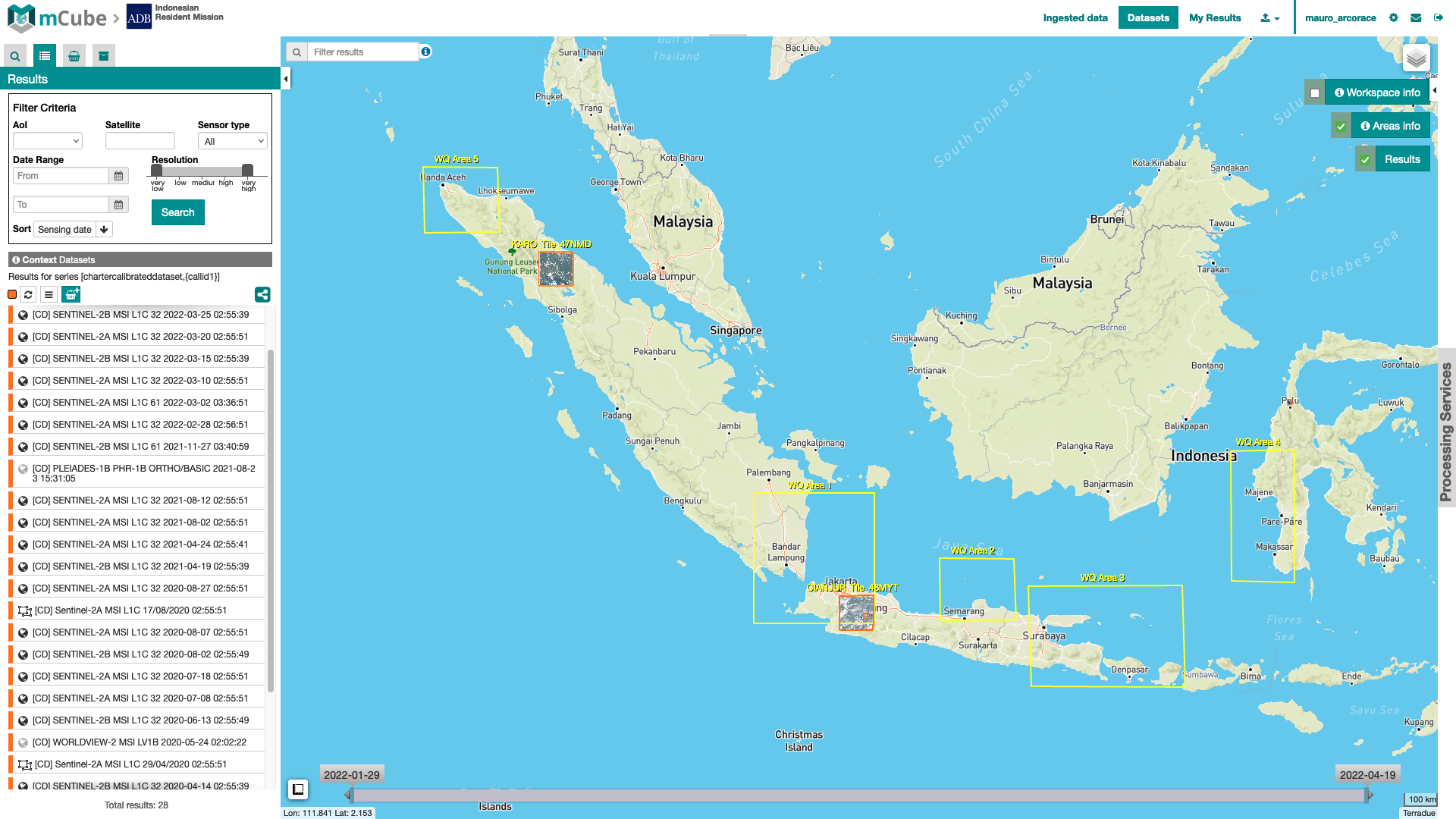
Welcome to the User Manual of the Multi Mission Mapper - mCube, the framework developed by Terradue that allows the deployment of customized platforms focused on EO data hosting with catalog, visualization and processing services.
The mCube framework allows the deployment of cloud-based environment for effective exploitation of multi-mission and multi-sensor satellite imagery data resources, i.e. a collaborative, virtual work environment providing access to EO and value-added products, and the tools, processors, and ICT resources required to work with them, through one coherent set of interfaces.
mCube provides access to:
-
open and free data as well as auxiliary external datasets / layers; in particular the Copernicus Sentinels and Landsat missions that have changed the way satellite EO can be used with large volumes of data from systematic acquisition and with a long-term commitment to guarantee a global observing capability (Radar and Optical),
-
Very High-Resolution imagery (e.g. WorldView-2/3, Pleiades and PlanetScope multispectral data) through Data as a Service (DaaS) mechanisms or via private collections uploaded by the user,
-
cost effective solutions to transform these data into actionable information.
This processing environment is leveraging the experience gained with the Geohazards Exploitation Platform, made available to the Geohazards community during the last 5+ years, and will directly inherit (in terms of technology and capabilities) from the ESA Charter Mapper.